3wordPhoto App
Allows users to add 3 word addresses to photos.

Client
what3words Ltd
Addressing & geocoding System
Year
2018
London, UK
Case Study Overview
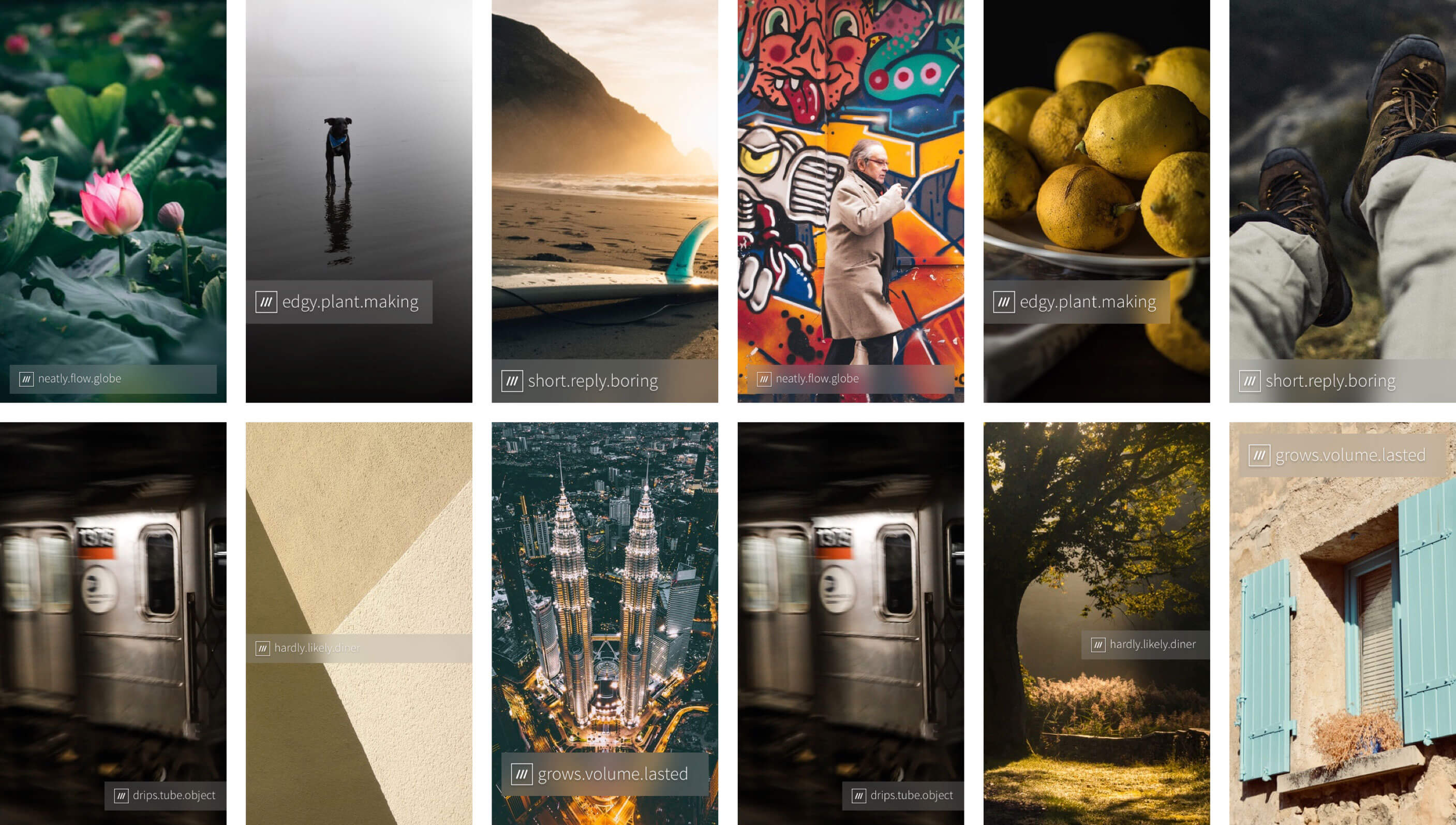
what3words has revolutionized the way we address locations by dividing the world into 3 meter x 3 meter squares and assigning each square a unique 3 word address. With the launch of 3WordPhoto, this innovative addressing system has now been extended to the world of photography.
3WordPhoto allows users to easily add customizable 3 word address labels to their photos, providing a simple and accurate way to indicate the exact location where the photo was taken. By adding these labels to your photos, you can share your experiences with others in a more precise and meaningful way.
Whether you are an avid traveler, a professional photographer, or simply someone who loves to capture special moments, 3WordPhoto offers an easy and intuitive way to add personalized location information to your photos. With just a few taps, you can add a 3 word address label to your photo, making it easy for others to identify the location and share in your experiences.
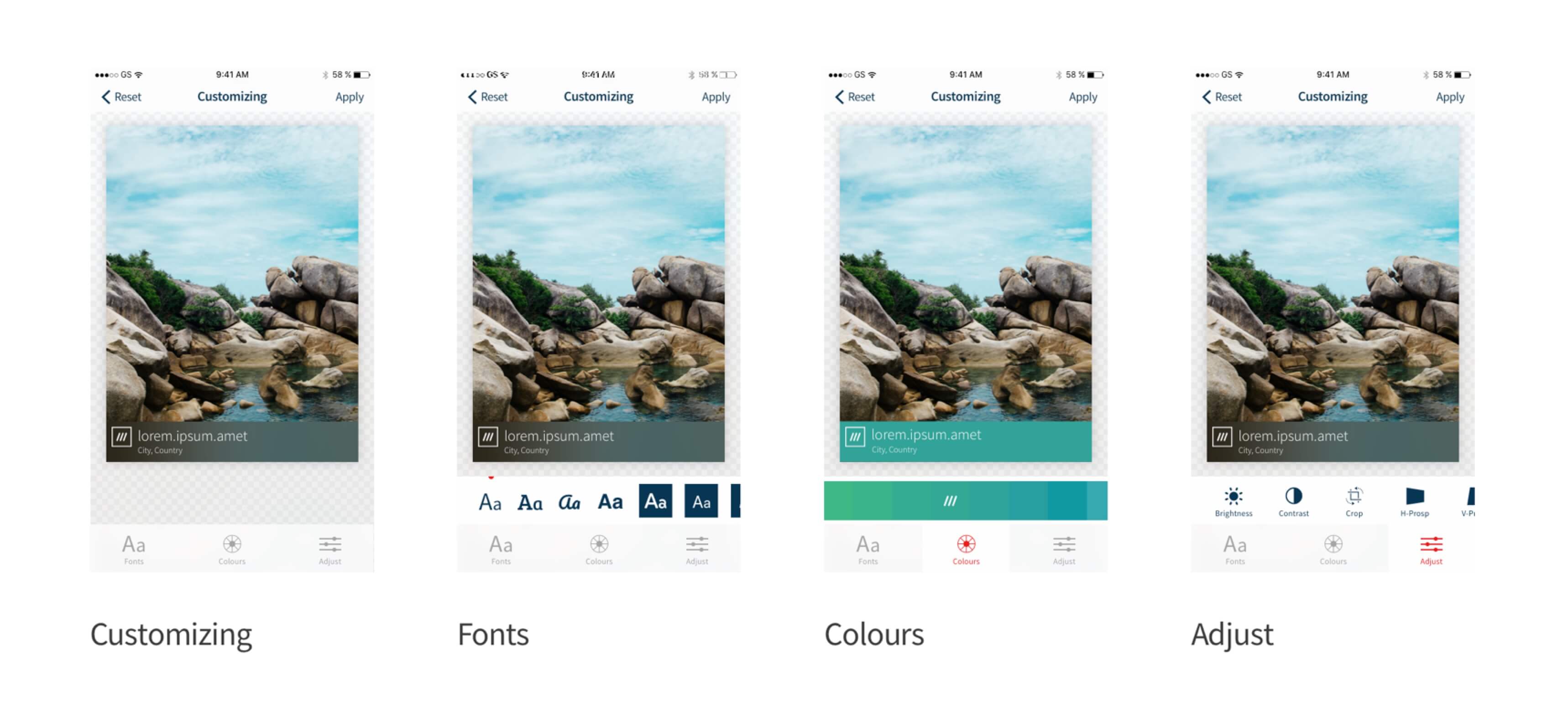
3WordPhoto also allows users to customize their labels, choosing from a variety of fonts and colors to match their personal style. And with the ability to share photos directly from the app to social media platforms or messaging apps, it's never been easier to share your photos with friends and family.
So whether you're exploring new destinations, capturing beautiful landscapes, or simply taking a selfie with friends, 3WordPhoto offers a unique and innovative way to add location context to your photos, allowing you to share your experiences with others in a more meaningful way.
Some information and details are excluded due to confidentiality reasons.
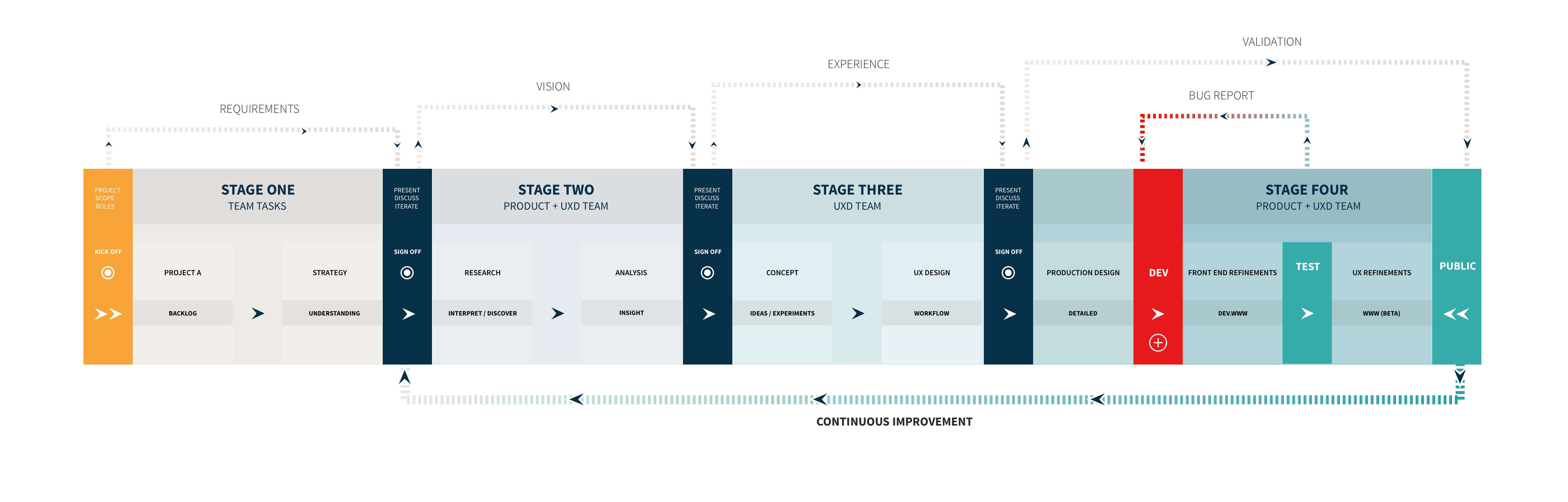
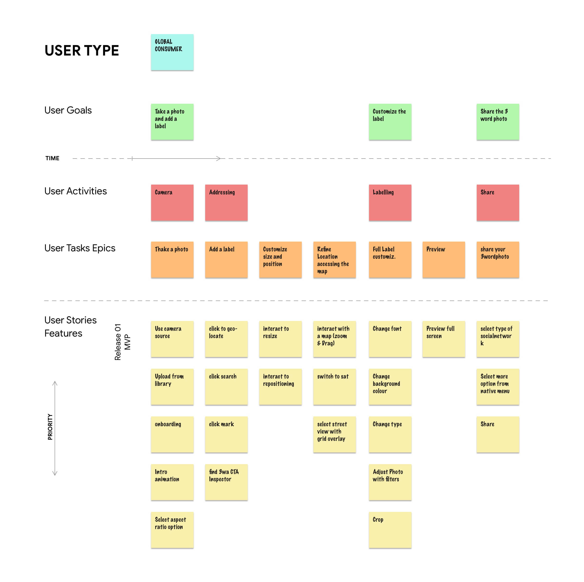
Managing the project
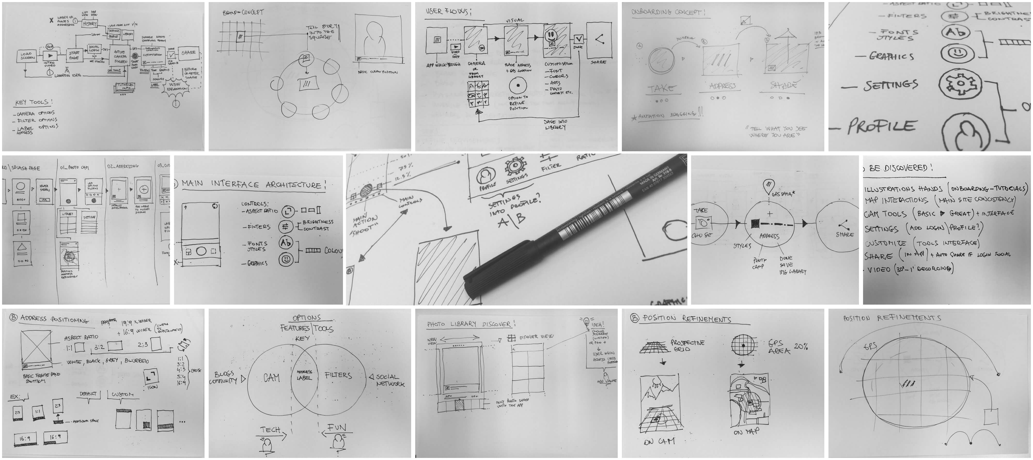
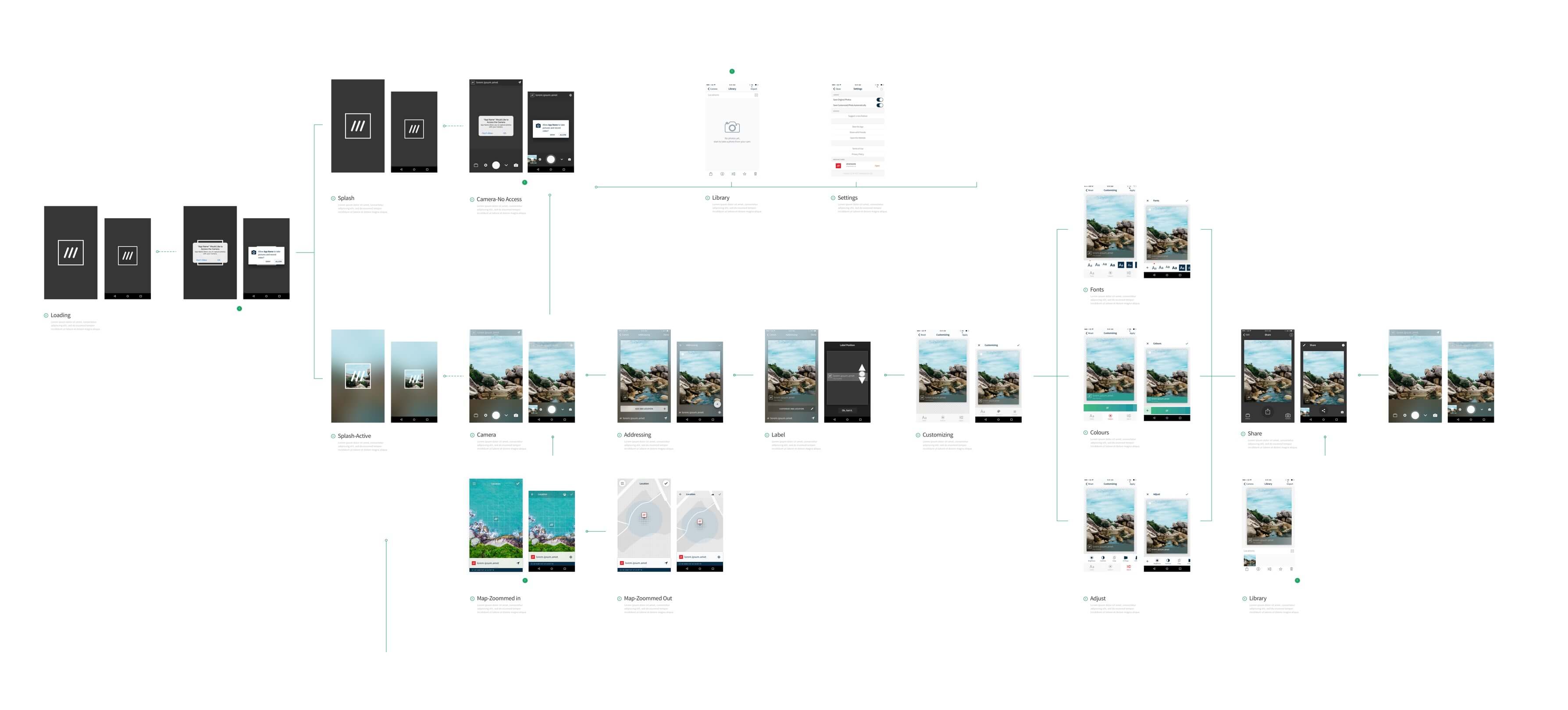
UX & Product Design work-flow
Problem & Opportunity
Geotagging photos has become a popular way to attach location information to photos by embedding latitude and longitude coordinates into the photo's metadata. While this information is saved in the file, it is not visible on the photo itself. However, there is a common misconception that geotags can prove that a photo has been taken at a specific location. In reality, the geotags in JPG files can be easily changed afterwards, making it difficult to verify the location of a photo.
Fortunately, there are ways to add geotags to your photos, even if you have a camera without GPS sensors. One option is to manually add geotags to your photo files. However, this can be a time-consuming process, and may not be practical for users who take many photos.
For those with smartphones, geotagging photos has become much easier, as many new cameras now come with GPS sensors that support geotagging. By simply activating this feature on your phone, you can easily add location information to your photos without any additional effort.
It's important to note that if you choose to save geotags in your photos and share them with others, they will be able to see the location where the photo was taken. This can be a privacy concern for some users, as sharing this information could reveal sensitive or personal details. If you prefer to keep your location private, it's best to avoid sharing geotagged photos or use instant messaging apps that modify image files to remove geotags.
Main challenge
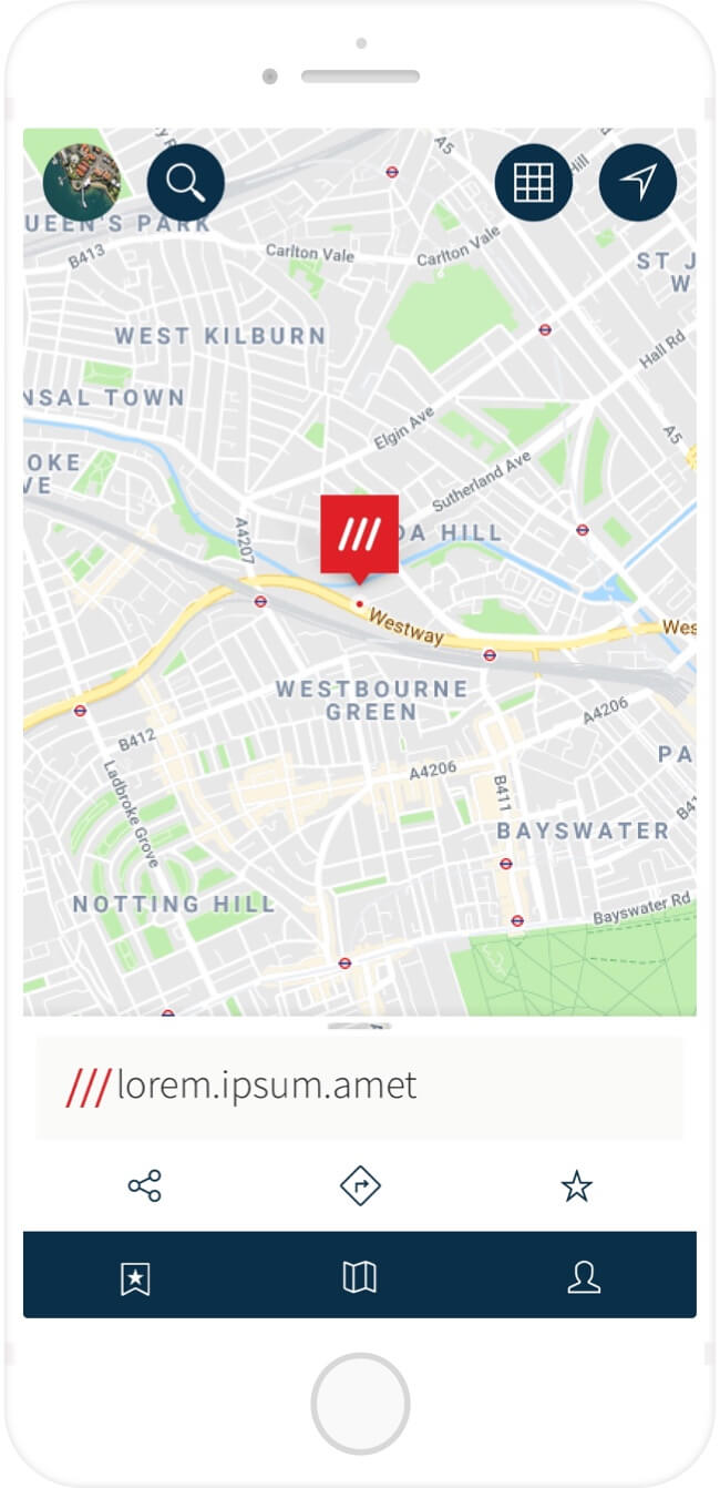
Geotag any Photos with a 3 word address:
The main challenge of this project is to create a solution that enables users to geotag any photo with a unique 3 word address. This means that the solution should be able to accurately identify the location where the photo was taken and assign it a unique 3 word address. This requires a robust geotagging algorithm that can accurately pinpoint the location of the photo, even in areas with poor GPS signal or no GPS at all.
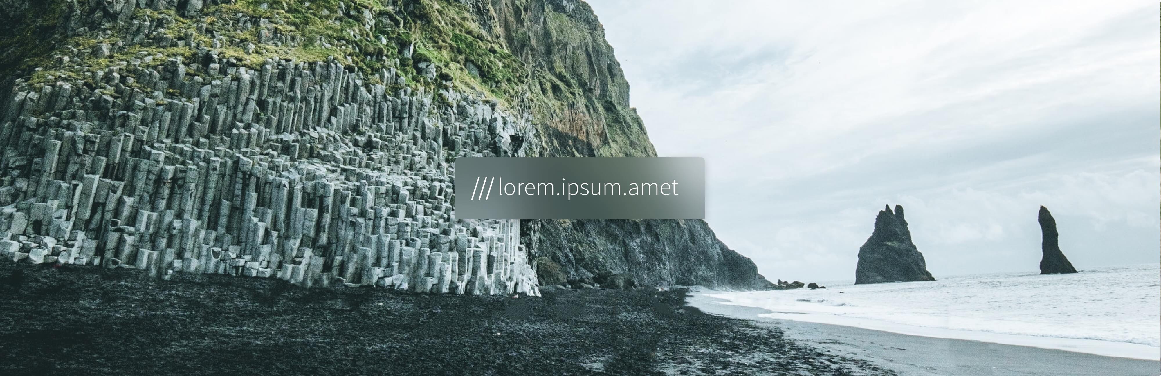
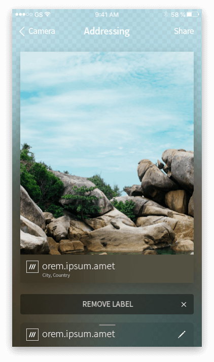
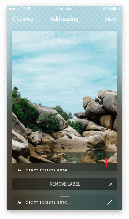
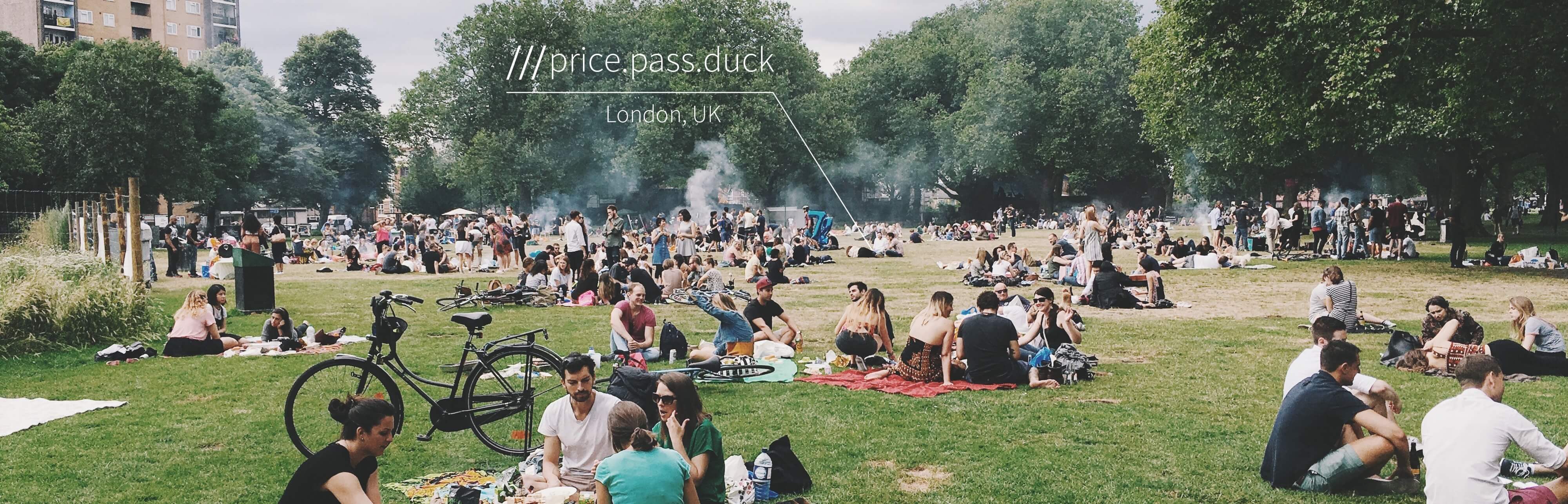
Display a label with the 3 word address on your Photos:
Once the 3 word address has been assigned to the photo, the next challenge is to display the label on the photo in a way that is aesthetically pleasing and easy to read. The label should be placed in a way that does not obscure the photo, and it should be visible enough to be easily read by anyone who views the photo. Additionally, the label should be customizable, allowing users to choose from different font sizes, colors, and styles.
Allow the users to Personalize and share their Photos:
Finally, the solution should allow users to personalize and share their photos with others. This means providing users with tools to edit their photos, such as adding filters, cropping, or adjusting brightness and contrast. The solution should also make it easy for users to share their photos on social media or through messaging apps, without compromising their privacy or security. This requires implementing secure sharing options that allow users to control who can access their photos and where they are shared. Overall, the main challenge is to create a solution that is user-friendly, accurate, and visually appealing, while also protecting user privacy and security.
My role
Lead Product Designer (UX-UI)
Solution
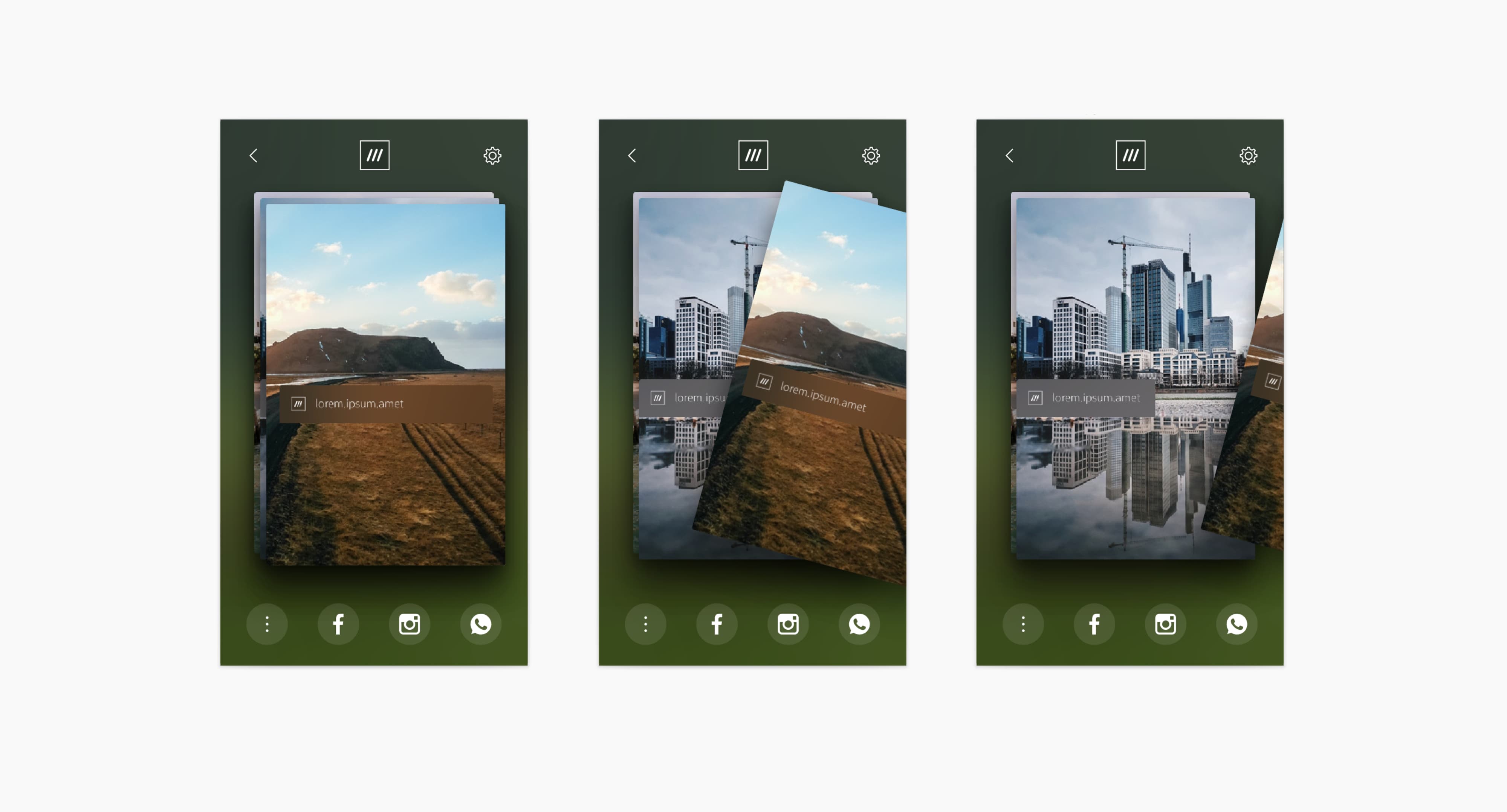
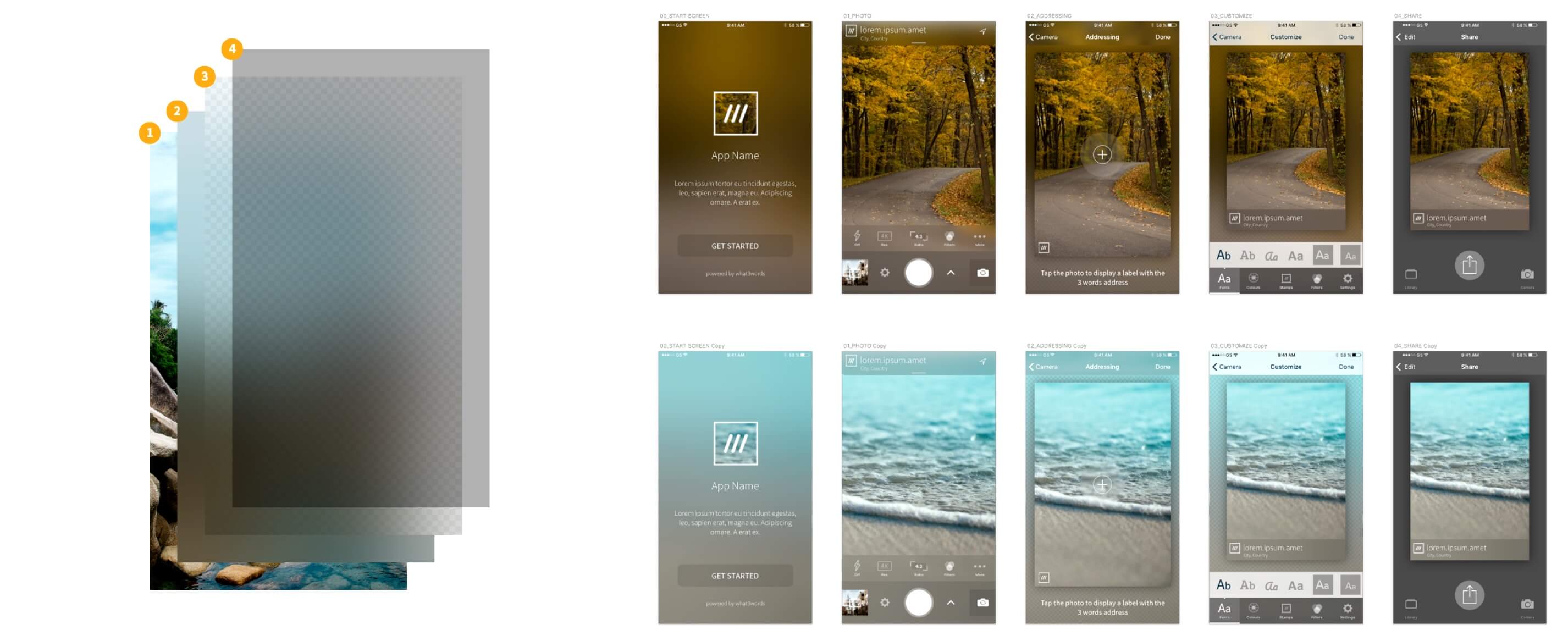
The solution aims to simplify geotagging photos by providing a user-friendly and customizable platform. The process is broken down into five main tasks:
A) Acquiring an image: Users can easily take a photo using their smartphone or camera.
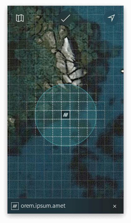
B) Refining image position: Starting with the GPS position of the photo, users can refine the position using a 3word map to pinpoint the exact location.
C) Labelling the photo with a 3 word address: Users can add a 3 word address label to the photo, which is generated based on the location data.
D) Customizing the 3 word label: Users can personalize the label by choosing different colors, fonts, and styles to match their preferences.
E) Sharing the labelled photo: Users can share the photo with a link to the 3 word address location, adding value to the content.
The location refinement process is crucial for ensuring accurate geotagging, and the customization feature adds a personal touch for increased user engagement. Overall, the solution provides an easy and efficient way to geotag photos with a 3 word address label.
High Social engagement with User Generated Content across Social media channels.
Social engagement
The Project
Approach
Product Audit
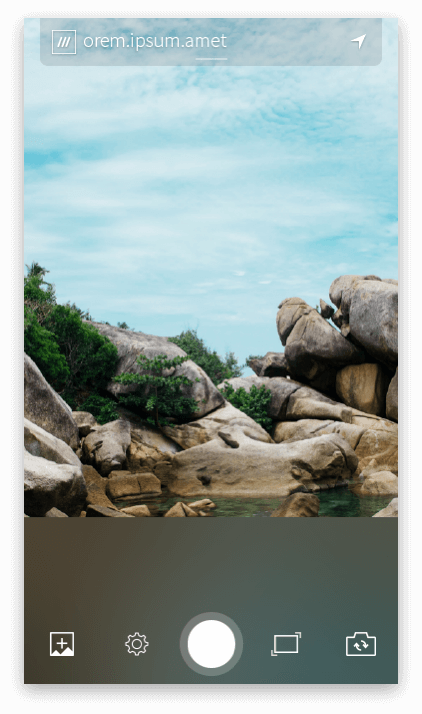
With the 3WordPhoto app, you can label your photos with a unique 3 word address and share them with your friends and family. This feature makes it easy to arrange a meeting spot, share the location of hidden street art or food trucks, and pinpoint scenic viewpoints. The app offers a simple user journey consisting of five main tasks:
Acquire an image
Refine the image position using a 3word map
Label the photo with a 3 word address
Customize the label with various fonts, colors, and types
Share your labeled photo with a link to the 3 word address location.
The key task in this process is the location refinement, which enables the user to pinpoint the exact position from where the photo was taken. Personalization options are also available to increase user engagement and allow them to share content with added value. Overall, the 3WordPhoto app offers a unique solution to geotagging photos, making it easy and convenient to share precise locations with others.
Research
In my research, my main objective was to investigate how to enhance the user's ability to share photos with a visual representation of their precise location, while ensuring a secure method to share the image using a link to the 3 word address location.
To accomplish this, I examined user behaviors when sharing photos on social media platforms and used this information to map out the key tasks involved in this process.
Through my research, I explored various ways to enable users to associate location refinement as the optimal approach for sharing geolocated photos with a high level of accuracy. I also educated users on the differences between GPS coordinates and 3 word addresses to promote better understanding and utilization of the latter.
“How do I tell my story to all the people of the world?“
What happened?
Where did it take place?
Who is involved?
When did it take place?
Why did that happen?
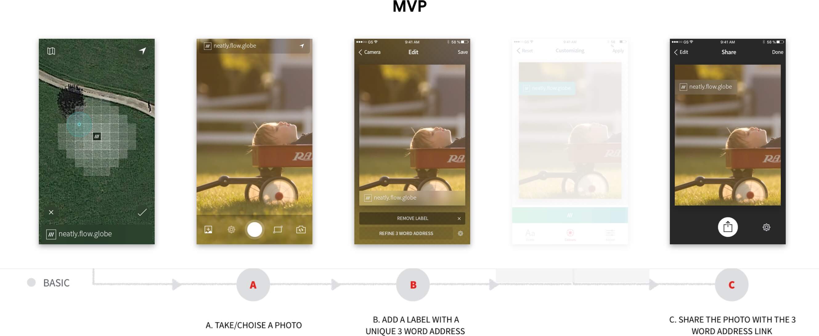
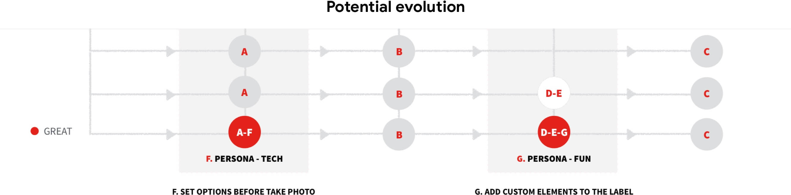
Scalable Solutions - Validation
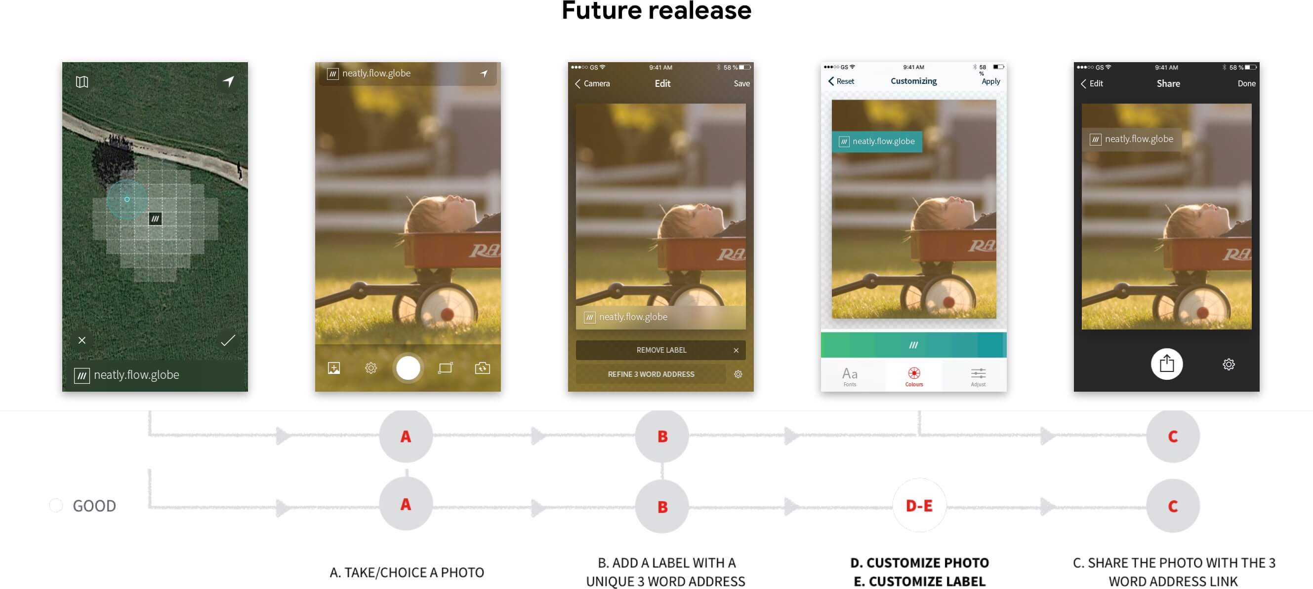
The proposed solution for geotagging photos with 3 word addresses involves the following steps:
A. Take/Choose a Photo: Users can either take a new photo or choose an existing one from their camera roll.
B. Add a Label with a Unique 3 Word Address: The user can add a label to the photo with a 3 word address that refers to the exact location where the photo was taken. This label can be customized with different colors, fonts, and other elements.
C. Share the Photo with the 3 Word Address Link: Once the label has been added, the user can share the photo with others along with a link to the 3 word address location. This link provides a visual way for others to find the exact location where the photo was taken.
D. Customize Photo: Users can customize the photo itself by adding filters, cropping, or adjusting other settings.
E. Customize Label: The label added to the photo can be further customized with options to change its size, position, and other attributes.
F. Set Options before Taking a Photo: Users can set various options before taking a photo, such as the quality of the image, the use of flash, and other settings.
G. Add Custom Elements to the Label: In addition to customizing the label's appearance, users can add custom elements to the label such as icons or other graphics.
These steps provide a scalable solution for geotagging photos with 3 word addresses and customizing them before sharing. By allowing users to add unique 3 word addresses to their photos and customize them with various options, it provides a more engaging and interactive experience for sharing geotagged photos.
Challenge
“Each Shot is a unique experience”
Atmosphere Concept
Here's a more descriptive rewrite of the Atmosphere Concept:
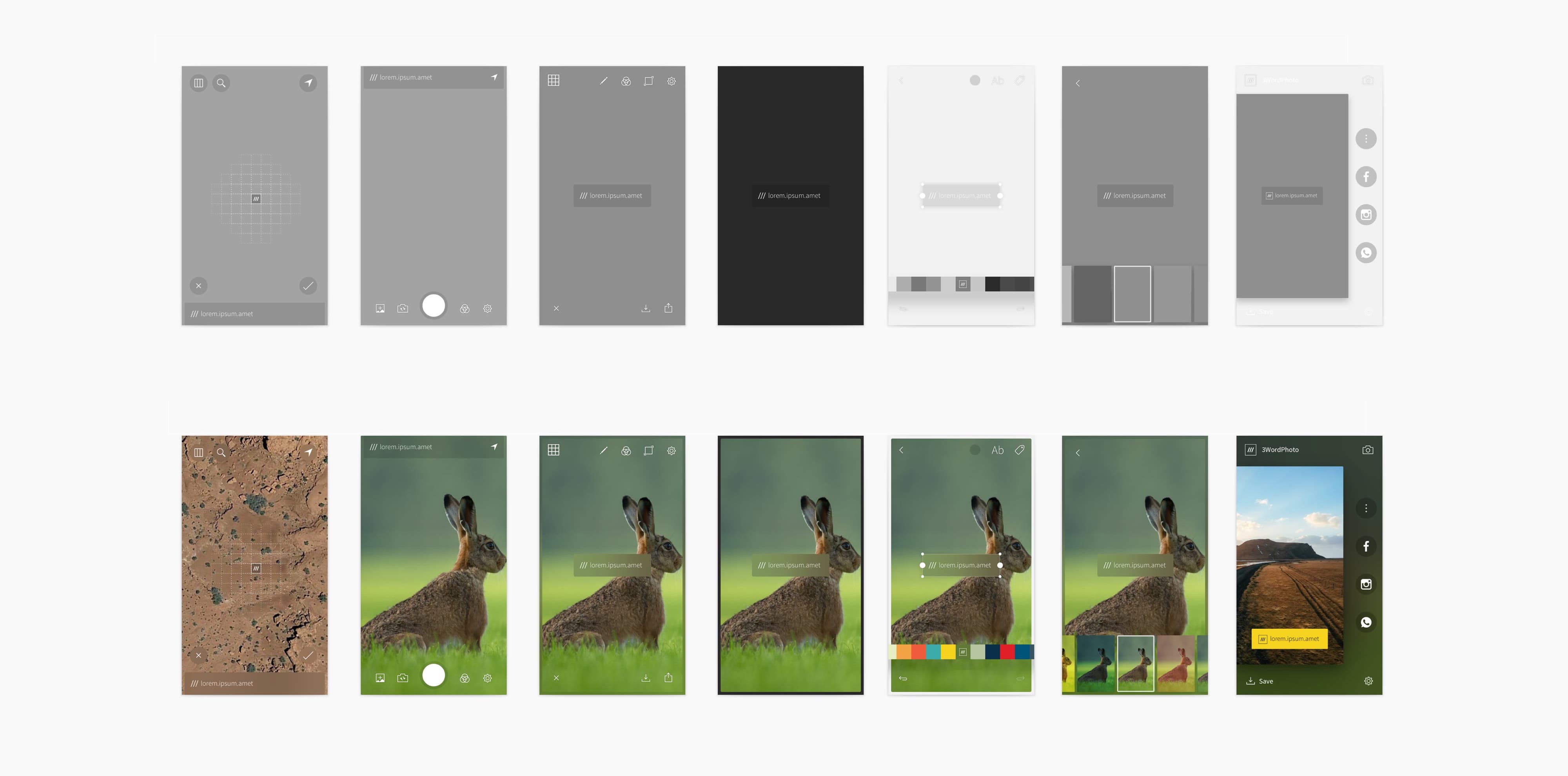
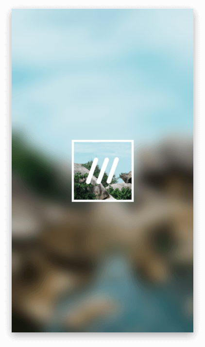
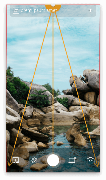
The Atmosphere Concept revolves around the image being taken and its source. This could refer to the camera or the device that is used to take the image.
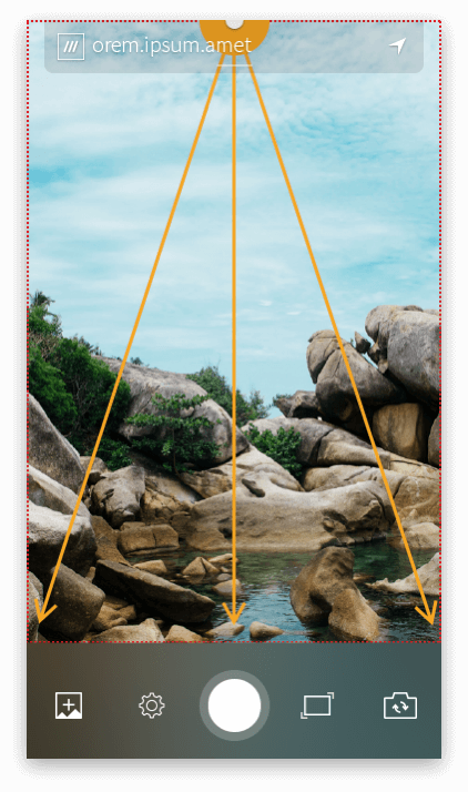
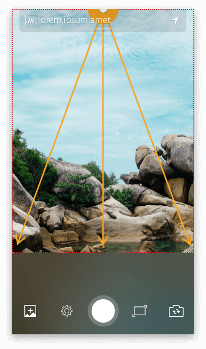
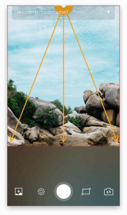
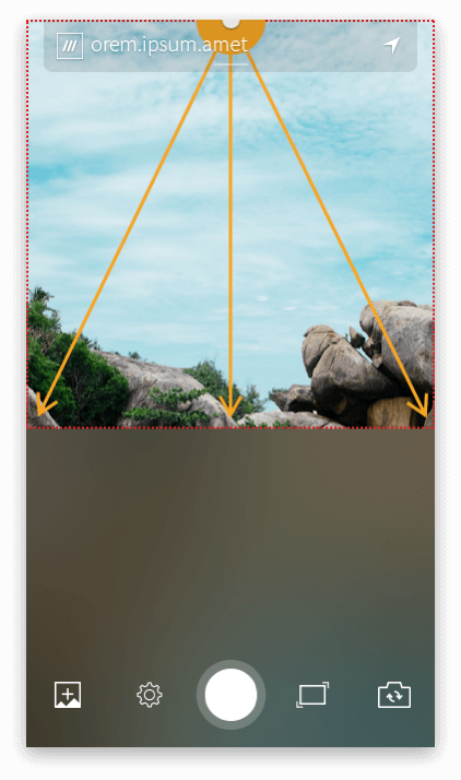
To illustrate the cropping aspect ratio of the camera source, a blur effect is used. This helps to show what the final image would look like with the chosen aspect ratio.
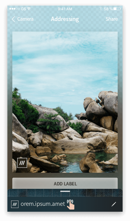
The Addressing screen is where the blur effect is primarily used. This screen allows users to add a unique 3-word address to their photos before sharing them.
Sometimes, the blur effect is also used in the Camera Screen. This is when the camera source overlaps with the tools and options on the screen. For instance, the 16:9 example could use the blur effect to show how the image would look when taken with this aspect ratio.
Camera tools and functionalities
Interaction Design
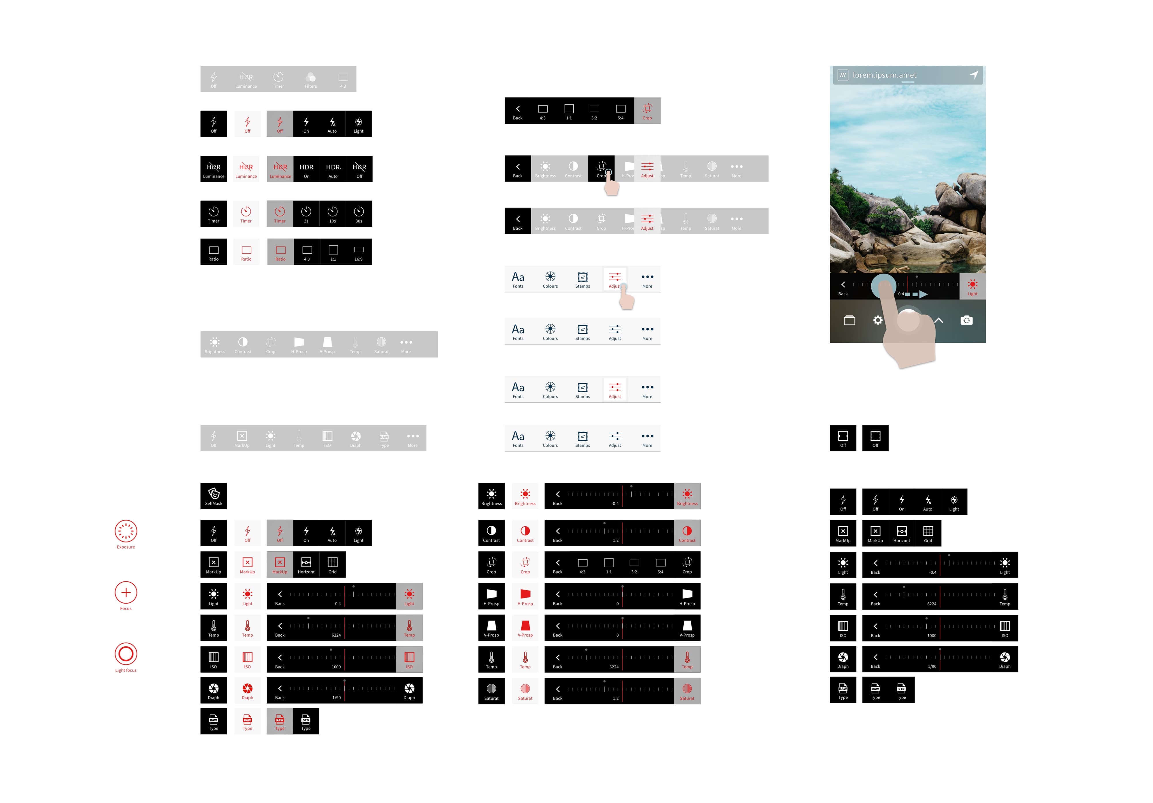
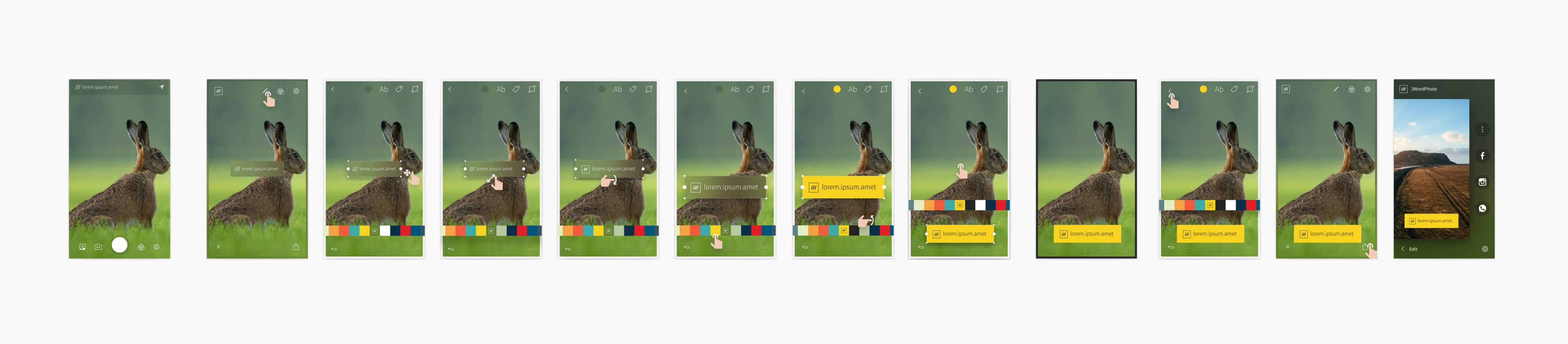
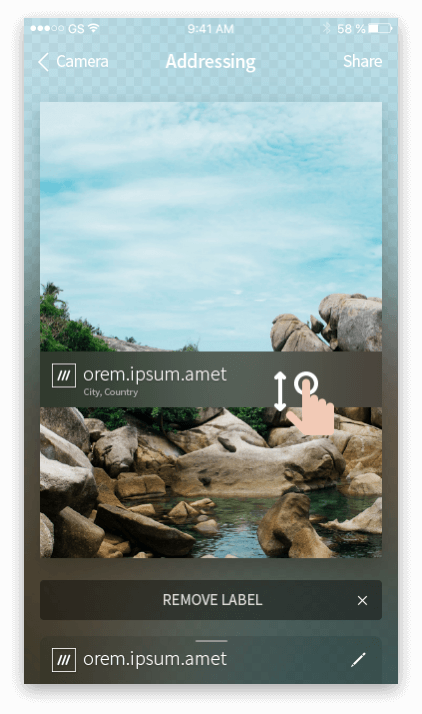
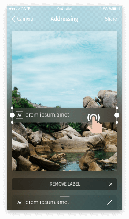
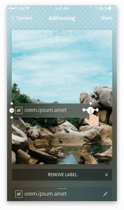
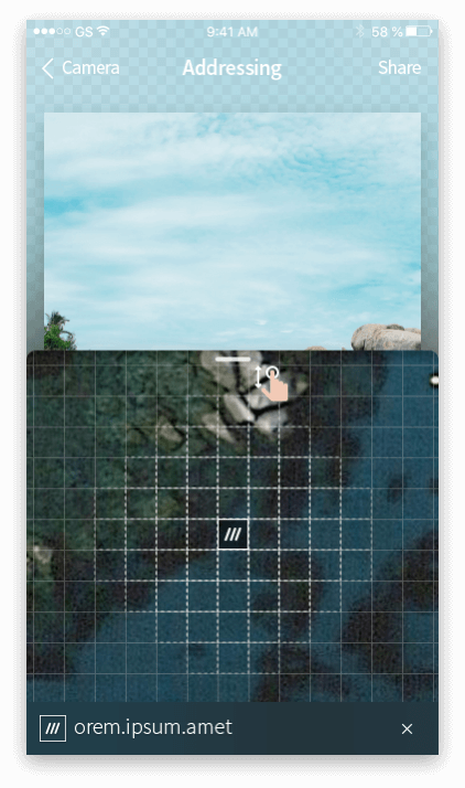
“Mark and refinement interaction”
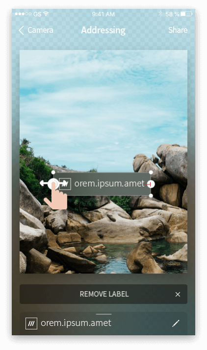
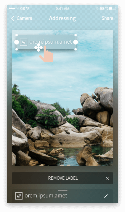
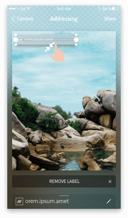
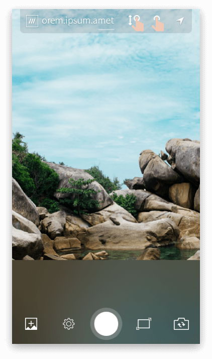
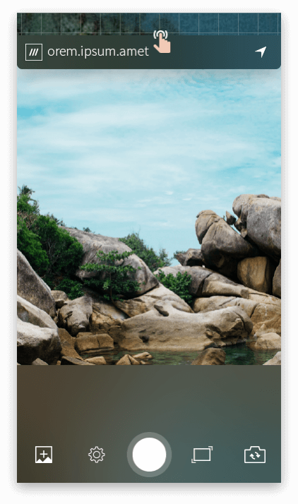
“Pinch with two fingers to zoom and move the 3 word address Label up or down.”
“Label customization”
The user will have complete control over the customization of labels, with options to choose font, colors, and background. Additionally, they will be able to select the type of label that best suits their needs. This level of flexibility allows for personalized labeling that can be tailored to fit any occasion or use case.
UX Strategy
Story Mapping: Task models and Scenarios
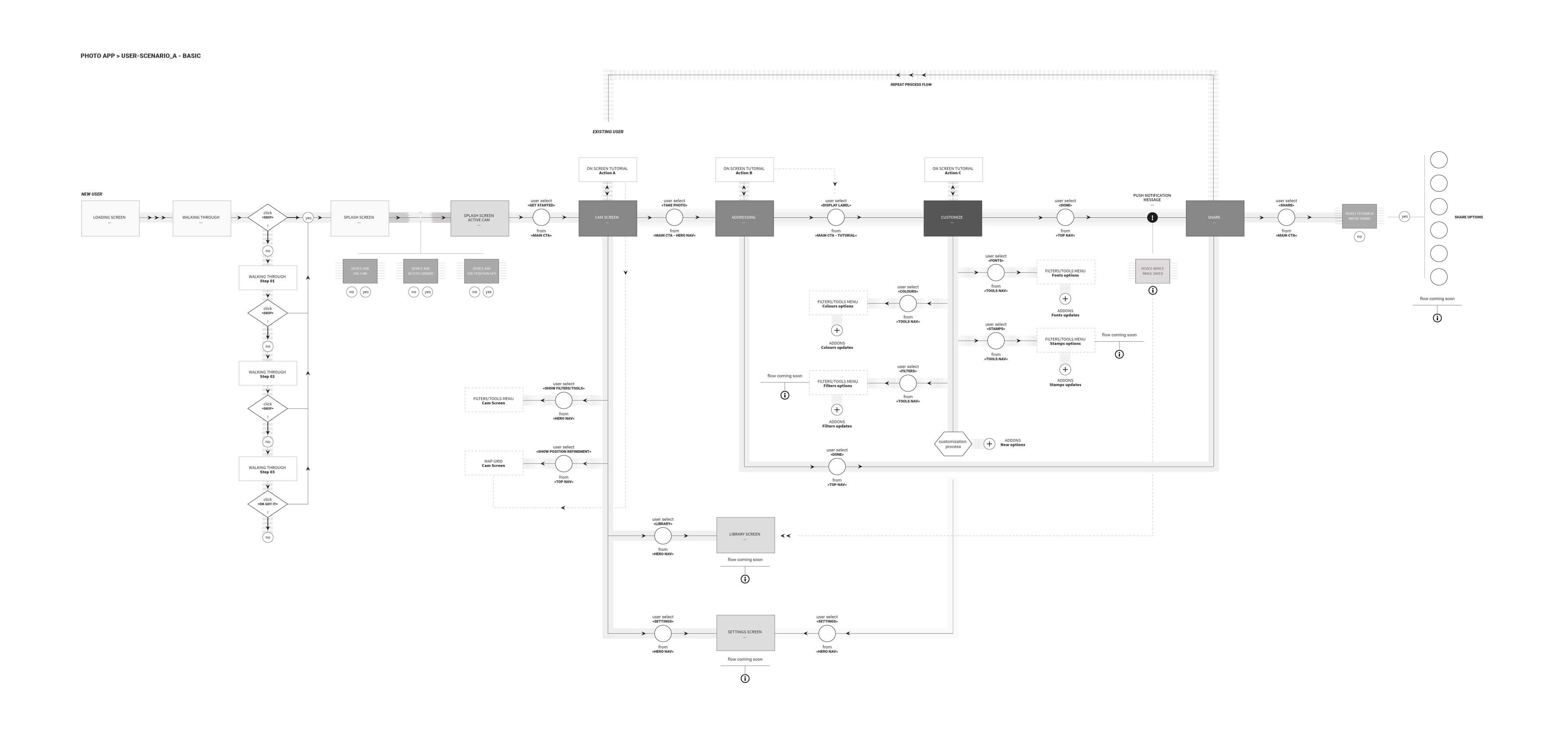
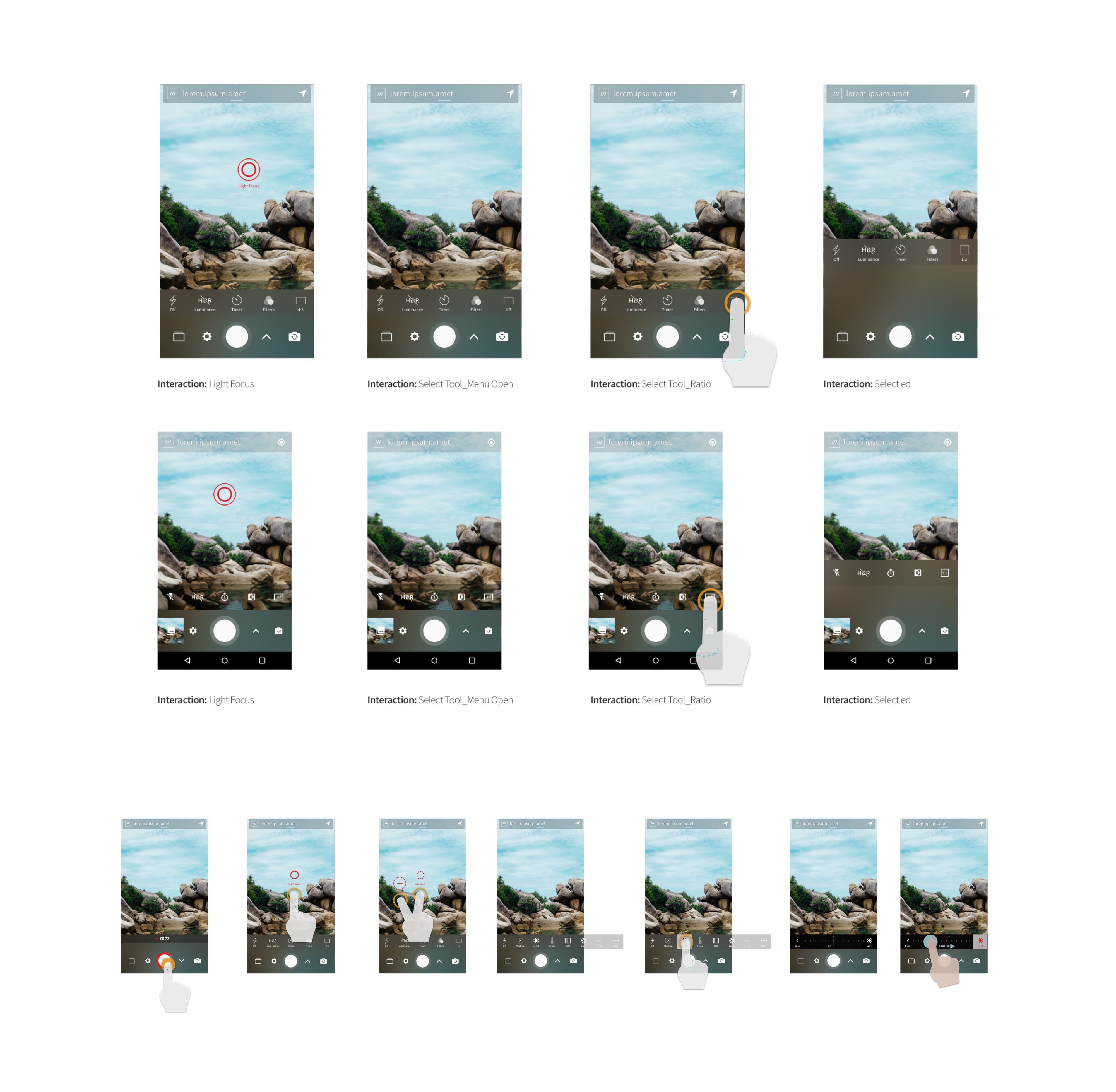
Camera Scenarios
Upon launching the app and granting necessary permissions, the user will be presented with an animation that transitions from the splash screen to the camera source. The camera source, which is used for the atmosphere concept, should fade in immediately after the user grants permissions, and the animations should be staggered.
The frame of the logo will be transformed into the border of the default (4:3) camera source aspect ratio. The camera tools will fade in from the bottom of the screen, while the map element will slide in from the top. This scenario will be triggered when the user opens the app and accesses the camera feature.

Camera Aspect Ratio
By default, the camera aspect ratio will be set to 4:3. As the user selects a different aspect ratio, the crop should animate smoothly between the different screen sizes by opening and closing the crop. This will allow the user to visualize how the image will be framed according to the selected aspect ratio.
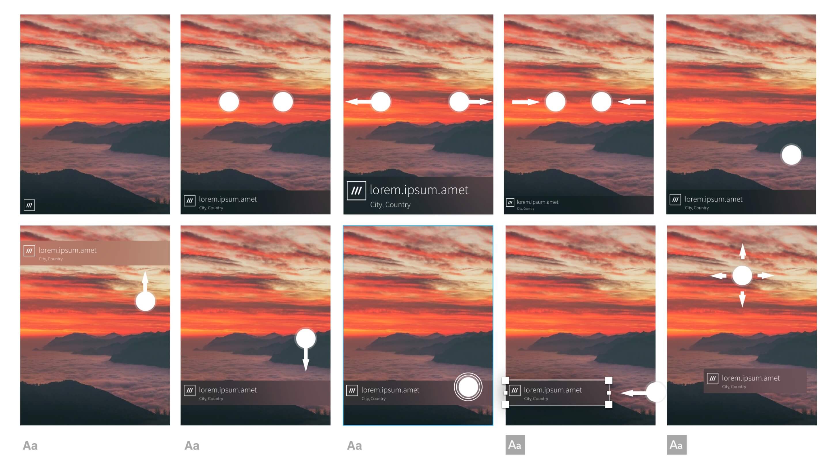
Add a Label


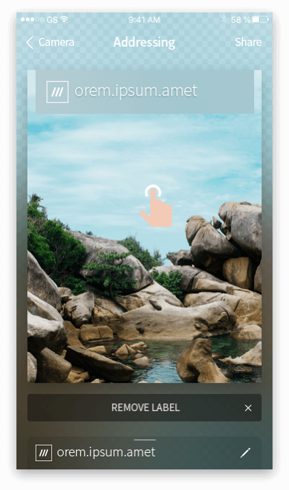
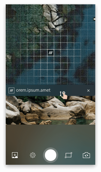
Accessing the Map
To access the map, the user can simply tap on the address label, and the map will smoothly slide up from the bottom of the screen. Upon tapping, the label's width will expand to 100%, and the app in the background will slightly dim. The map element will initially pop up to reveal a small section of the map, inviting the user to explore more. As the user scrolls up, the map will gradually expand, and if they release it once it occupies more than 50% of the screen, it will smoothly transition to the "End Animation" screen, displaying the full map with the precise 3-word location marked.

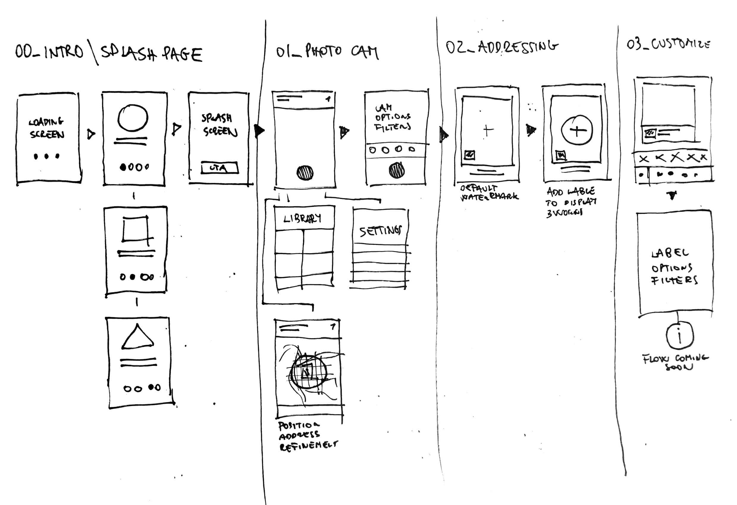
UX Architecture
User flows and main structure
Learnings, results and output
The product was launched in December 2017 and received an overwhelming response from users who found it easy to use and appreciated the instant process of sharing 3 word photos on social media. The app successfully addressed the pain point of users who struggled to put a geotagged link on their photos.
The feedback received from users highlighted their desire for more freedom to customize their photos with 3 word address labels. They also expressed hope for future releases that allow them to be more creative using the app. This learning points towards the need to cater to different personas such as tech-oriented users like professional photographers and bloggers, as well as the young audience who use the app for fun.
To further improve the product, a user testing plan has been developed to research different outputs that cater to the needs of these personas. This will enable the team to identify ways to enhance the app's features and capabilities for a wider range of users.
Download the app
The App has been integrated on the what3words main application, check it out!
«”You’ll see 3 word addresses displayed by hotels, restaurants, travel guides and websites. They can be used in 20+ languages and are much simpler to remember, use and communicate than regular addresses. They’re also far more accurate and reliable.”»
Tags
#Travel #Tourism #Voice #Navigation #PostalServices, #Automotive & #Mobility #Events #emergency-services. #Geolocation #GoogleMaps #API #wha3words #Grid-System #UX #ProductDesign #Interactions #ValueProposition
Fair dealing Disclaimer
Sections 29 and 30 of the Copyright, Designs and Patents Act 1988
I've written this Case Study for purposes such as research and private study, criticism or review, or news reporting. I’ve used part of the copy from the author website (what3words.com) that you can see under the quotations «”…”»